


Geotagging+

Descripción de Geotagging+
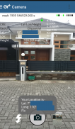
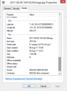
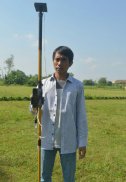
This app allows you to take image and measure with low-cost GNSS module (like U-blox GNSS module or E-GNSS from potretudara : http://www.potretudara.com/low-cost-gps-gis/ ). Measured coordinates from low-cost GNSS module are stored to EXIF image metadata in time when you tap the "capture" button. Use this to create your geotagging more precise to sub-meter level. Very useful for census, GIS support, reporting issue, and others.
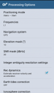
You can still use internal GNSS for geotagging by deactivate BASE and ROVER in the Input Stream menu. Obviously none of the precision algorithm found in RTKLIB can be use.
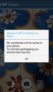
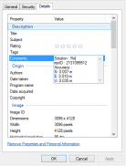
Image taken by this app will have coordinate metadata, accuracy, and solution type (internal, single, float, or fix).
Heavily based on RtkGps+ from Ronan LE MEILLAT, this is a fork of his work. Original licenses are in the "About/Legacy Info" screen. Thanks to all contributors to respect this clause.
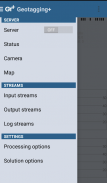
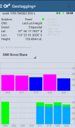
This app is RTKGPS+-like with additional Camera menu. You still can use this app for surveying, tracking, etc. like RTKGPS+ do.
This app is a port of RTKLIB 2.4.3b 28 developed by Tomoji Takasu (http://http://www.rtklib.com/). This RTKLIB 2.4.3 is modified by rtklibexplorer and named RTKLIB 2.4.3 demo 5 b 28 (https://github.com/rtklibexplorer/RTKLIB). If you do not know what this application is, this application is probably not what you are looking for!
App manual : http://bit.ly/shortmanual
Esta aplicación le permite tomar imágenes y medir el módulo de GNSS con bajo costo (como el módulo de GNSS U-Blox o E-GNSS de potretudara: http://www.potretudara.com/low-cost-gps-gis/). coordenadas medidas de módulo de bajo costo GNSS se almacenan a EXIF metadatos de la imagen en el tiempo cuando se toca el botón de "captura". Usar esto para crear su geoetiquetado más precisa a nivel de sub-metro. Muy útil para el censo, el apoyo SIG, emisión de informes, y otros.
Puede seguir utilizando GNSS interno para el geoetiquetado por la base y el receptor remoto Desactivar en el menú de flujo de entrada. Obviamente ninguno de precisión del algoritmo se encuentra en RTKLIB se puede utilizar.
Imagen tomada por esta aplicación tendrá coordinar metadatos, la exactitud, y el tipo de solución (interno, solo, float, o fix).
En gran medida basado en RtkGps + de Ronan LE Meillat, este es un tenedor de su obra. licencias originales están en la pantalla "Acerca de / Legacy Info". Gracias a todos los contribuyentes a respetar esta cláusula.
Esta aplicación es RTKGPS + -como con el menú de la cámara adicional. Todavía se puede utilizar esta aplicación para la supervisión, seguimiento, etc., como RTKGPS + do.
Esta aplicación es un puerto de RTKLIB 2.4.3b 28 desarrollado por Tomoji Takasu (http: // http: //www.rtklib.com/). Este RTKLIB 2.4.3 es modificado por rtklibexplorer y nombrado RTKLIB 2.4.3 demostración 5 b 28 (https://github.com/rtklibexplorer/RTKLIB). Si usted no sabe lo que esta aplicación es, esta aplicación no es probablemente lo que usted está buscando!
manual de aplicación: http://bit.ly/shortmanual


